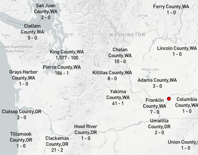
The new Covid-19 by County layer is ready for viewing. It uses the same display structure as the one by State but has a completely different source (usafacts.org). Drag the map around to an area of interest and zoom in. If a County has any cases, the info will be displayed, otherwise not. Zooming in exposes new counties.
Here's the Link. I focused it initially around Washington State, because. When you drag and zoom the map a permalink url is automatic, so just save the link.